Rand McNally Celebrates 90 Years of the "Great American Road Trip"
 |
2014 edition of America's #1 Road Atlas will be 90th
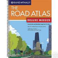
SKOKIE, IL--April 15, 2013: Today, Rand McNally's 90th edition of America's #1 Road Atlas - the publication that has been commonly found in cars since the days of the Model T -- has been declared road-ready. From family vacations and roads trips with friends, to weekend getaways and unexpected adventures, Rand McNally has helped generations of explorers create long lasting memories - from every page of the atlas.
And to celebrate the 90th anniversary, Rand McNally today also officially launched an ebook version of the atlas as well as an iOS application for iPad.
The first Road Atlas
The inaugural edition of the atlas, published in 1924, was referred to as the "Rand McNally Auto Chum." The nation was embracing car travel as nearly two million Ford Model T's hit the road with gas costing $.21 per gallon.1 Featuring the 48 states that existed, hand drawn, and covering only roads made of concrete, the atlas did not contain many of the features considered common for today's printed, online, and mobile maps.
In 1924, the Road Atlas:
- Did not identify roads by number; instead roads were listed by their
names, such as Roosevelt Highway. In fact, the atlas depicted zero miles of
interstate, as those roads did not yet exist.
- Today's atlas contains more than 47,000 miles of interstate included in 160,000 miles of highways.
- Did not include an index for cities, or other places. If a driver
didn't know where a town was located, he or she would have to page through
the atlas to find it.
- The current Road Atlas features eight pages of detailed index with tens of thousands of points of interest (including all 59 U.S. National Parks in addition to place names).
- Did not appear in full color. The 1924 atlas was printed in only two
colors, dark blue and red. The first full-color edition was printed in
1960.
- Today's maps use color to indicate road classification, terrain, and city size among other descriptive details.
The 90th Anniversary Edition
Ninety years later, the 2014 Edition of the Rand McNally Road Atlas provides:
- Valuable coupons in the inside cover for lodging, camping and auto club membership
- Best of the Road 2012 towns and road trips -- editor-curated journeys that celebrate the uniqueness of small towns in America
- Multiple sizes and formats including versions with large scale maps, standard sizes, and a new easy-to-read midsize
- URLs and QR codes (smart phone tags) for additional up-to-the moment information such as road construction, emergency information and details to enhance the trip
- Incredible detail and updates of roads, city inserts, places, and index information
In celebration of the 90th anniversary, Rand McNally is hosting a retrospective of Road Atlas covers through the years at Rand McNally 90 years . Road travelers are invited to visit the page and "like" their favorite covers -- from the hand-illustrated scenics of the 1930s to the graphical mid-century modern covers of the 1960s.
Visit Road Atlas for more information on all Road Atlas products.
1 Ford Model T facts -- Model T Club . Gas Prices -- Antique Automobile Club of America.


